
Days Two and Three on the WABDR
This article is the third in a five article series telling the story of my week-long motocamping trip on the Washington Backcountry Discovery Route (WABDR) in the Fall of 2022. If you haven’t already seen the first article, start here!
The Route for Day Two
My plan for day two on the WABDR consisted of 130-150 miles of riding, to be done on a mix of National Forest roads and backroads. I’d start my day just outside of Conconully and then slowly make my way South to camp outside of Lake Chelan, WA. I would have a few options for campsites, and the specific site decision would later come down to my energy levels and the amount of sunlight left in the evening.

Highlights of Day Two
To kick off the second day on the WABDR, I left my campsite in the hills and returned to the small town of Conconully. Conconully has a small town feel, and its residents were out having garage sales for Labor Day while all of the tourists were passing through town. The gas station didn’t open until 9AM, so I mucked about to see what the little town had to offer. The first thing to catch my eye was the little post office that had a surprisingly steady stream of visitors for a Sunday morning.

I also ran into a fellow WABDR rider, Ron. Ron was at the last leg of his trip because he was headed North, and South to North is the direction that people with functional motorcycles go because they can actually ride on the highway both ways. Just around this time, the gas station opened up. Perfect timing!

After paying a painful $7/gallon for a tank of premium gas, I packed up and started my journey South for the day!
The first attraction of the day was the Historical Ruby Townsite.

Riding a little faster now, I crested a hill and then descended into a valley on the opposite side of the sign. I had to be cautious during this entire segment due to bulbous cows randomly materializing in the middle of the road.

The road soon opened up considerably, and I was able to knock out some miles quickly.
On my way out of this valley I rode past an awesome treehouse-looking structure on someone’s property.

The next stop was a big lake! Leader lake specifically. I reached Leader lake only 20 minutes after the stilt house picture was taken. The roads were empty and it was a beautiful day out! I was planning on washing off in the lake, but as I approached the water I discovered thick algae blooms at every shoreline entrance, so a bath would have to wait.

I took a few minutes to destroy my lunch of three granola bars, and I hopped back on the trail. The upcoming section was a grueling 70 miles of Forest Service roads, and it was full of hidden sand pits. I didn’t capture too many images in this section, mostly due to the lack of interesting views.

At some point, I exited the green forest and entered another burned area. This area differed from the others in its vast openness and dramatic canyon walls. The road alternated between an old paved surface and gravel. After so many miles of dirt I was starting to appreciate the reliable grip that pavement had to offer.


Another 15 miles of rough riding, and I was nearing the summit of Cooper Mountain – one of my primary points of interest for the day!

Just a few more miles and I reached the top of Cooper Mountain at 5856ft! It was a little breezy at the top, but otherwise a perfect day to be standing up so high in the mountains.

I explored the summit area for a bit longer and discovered a false owl installed on one of the rocks (see below). Some other riders arrived and asked me if I had seen any ladybugs on the owl. Ladybugs? What a weird question… As it turned out, the other rider had heard the locals installed the owl to prevent the nearby birds from eating the ladybugs (which apparently liked the rock?). He said that the locals then harvested the ladybugs, for reasons I can only speculate – possibly for animal food or natural control of other pests.

I dropped down a few thousand feet towards Lake Chelan and couldn’t believe my eyes as I approached town. Some of the homes in this community had helicopter pads in their lawns (no pictures sadly). Clearly I underestimated the prosperity of the town’s occupants.

I was eager to get into the water since I had missed my swimming opportunity earlier in the day at Leader Lake. Luckily, I found a developed (and gated, but that’s no problem for a dual sport 🙂 ) set of allocated housing plots that had yet to start construction on the home builds. To my extreme pleasure, these plots also had brand new private boardwalks, which let me swim and clean off in solitude.

Finally clean, I headed up to my last destination of the day – my campsite! Depending upon the campsite that I chose, I might have had to ride a section of the WABDR called “The Jungle”. It is named as such because it is steep, exposed, rough, and littered with burnt trees – fallen just about at head height and waiting to decapitate those who take their focus off of the trail for even a few seconds.
As the sun was setting and I was tired from the long day, I decided to take the easy way out and camp at the nearby “Snowberry Bowl” Forest Service campground.

That’s a wrap on day two! While it had only been less than 48 hours since I started at the Canadian border, I had what felt like at least a week’s worth of experiences to process while I slept.

The Route for Day Three
My third day motocamping the WABDR was quite the adventure. The major highlights for the day were a fire lookout in the middle of the ride called “Sugarloaf Lookout Tower” and the summit of Chumstick Mountain. I made such good time in the morning that I rode 145 miles in total, which was twice as far as I had originally planned to travel! I began at my campsite just South of Lake Chelan and headed all the way down through the towns of Ardenvoir, Cashmere, and Wenatchee. At the end of the day, I set up camp in some remote mountains south of Wenatchee.

Highlights of Day Three
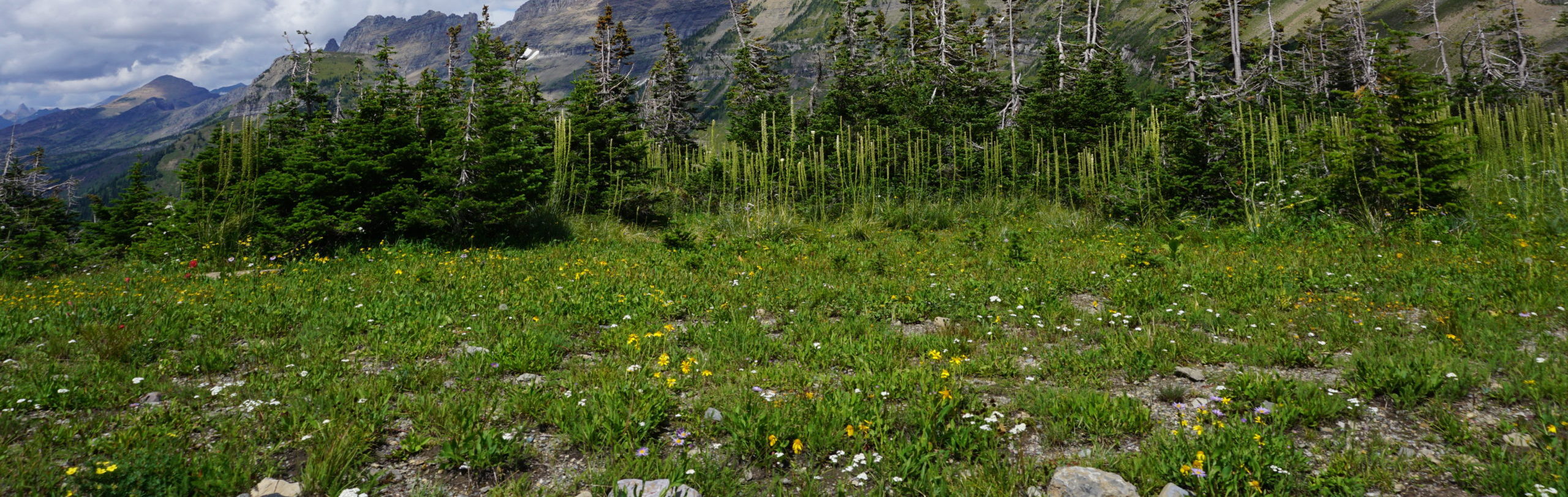
To start off the day I woke up early from my campsite at the Snowberry campground and heated up some freeze-dried oatmeal. I knew a big day lay in wait for me, so I quickly packed up my tent and gear. On the way out of camp some beautiful plants caught my eye: some tufty Fireweed and California Wildrose that had already flowered.


I continued onto the section of the WABDR called “The Jungle”, which is an abandoned road that was fighting to stay open. It was treacherous, exposed, steep, and rocky. Not a bad way to wake up in the morning! I tried, and failed, to capture the true nature of The Jungle in pictures. The images below were my best attempts to depict the sustained steepness and cliff-like nature of the road.


As I neared the top of The Jungle, the sun had come out, and I was treated to a fantastic view of Lake Chelan!

Onwards I went, riding alongside the ridge crest of Stormy mountain, known as Slide Ridge. As I came close to the campsite I was originally planning to stay at the previous night, I discovered that some hunters were already camping there! This validated my decision to stay in the Snowberry Campground because Slide Ridge had far fewer places to pitch a tent.

I began to descend the South end of Slide Ridge and found one of my favorite views during the entire trip so far. I’m a sucker for smooth dirt roads and wide-open skies, which makes me easy to please on the outskirts of mountains.

Twenty miles later I had reached my first resupply town of the day, Ardenvoir. Ardenvoir is such a small and remote town that I completely missed the gas station the first time I passed through. I was riding back into the woods when I realized that I had already driven through the entire town. I turned around to find the gas station a distance away from my main route – I had missed a turn.

I wandered down a small path past the gas station’s dumpsters to the river that crosses through town. Someone had left a camp chair in the perfect spot to take a break!

Alas, I had to leave the quiet river and continue on. I kickstarted my bike, checked my topographic maps one more time, put up the kickstand, and rolled on the throttle. In just a few minutes I had climbed quite a ways out of town, and soon I was in the golden foothills that I had become so familiar with during the trip.

On and on I rode – playing cat and mouse with a set of high voltage power lines for the better part of 20 miles. The forest clear-cut for these power lines is so large that it can easily be seen from Satellite maps, and out of curiosity I later managed to trace these power lines all the way to a massive hydroelectric power plant called the Chief Joseph Dam. At the end of these 20 miles I had arrived at one of the day’s main highlights, the Sugarloaf Lookout tower! The tower is relatively accessible – I was able to ride up most of the way and then hike another half mile up to the structure.

Sugarloaf Lookout was something special, and it was a fantastic day out too. Inside the lookout I met the seasonal volunteers, Gary and Lori, and their young black lab, Misty. They were staying at the lookout and acting as fire spotters during the fire season. Gary told me that they had actually called in the two nearby fires that had been filling the valley with smoke, and that it had been the biggest fire of the season so far!

I walked down the wooden steps of the lookout and was greeted by a smoky view of the Cascade mountain range. Glacier Peak was just peeking out of the smoke layer, seen on the right side of the picture below. The tops of the Enchantments were also visible from afar.
When I returned to my bike, I found that it had fallen. Kickstands can be unreliable out in soft dirt, and I should have leaned the XR against a tree. Thankfully, everything seemed to be okay, and I moved on to eating lunch, which was a double serving of freeze-dried chili!

I repacked the XR and hopped back on the road. Another 13 miles of dusty fire roads, and I was standing on the summit of Chumstick mountain, which was the other highlight of the day’s ride. As mentioned above, I had initially planned to camp at this spot, but I had arrived much earlier than expected (~2PM) and it was windy, which would have made for a rough night in the tent, so I decided to press on! This choice added 70 miles to my day, so I needed to get moving.

I rolled down 15 miles into the town of Cashmere, which is a rural community heavily centered around orchards, cider houses, and wineries. I didn’t have much time to explore due to my updated travel agenda, so I fueled the XR and continued on. Shortly before I descended into the city of Wenatchee, I slid into a mile-long section of deep sand. I’d attempt to slow down and there was no grip. I’d go to put a foot down, and the ground never appeared. The sand might have been an entire foot deep at its worst. Fortunately, I had significant prior experience in sand from racing downhill mountain bikes, and I know how to tackle it: keep the throttle slightly open, keep the bars as straight as possible, and keep the weight on the rear tire. When in doubt, throttle out.


I managed to survive the sandy stretch of doom and entered the bustling city of Wenatchee, though I only skirted around the edge of the city to get gas and mediocre tacos at a local Mexican restaurant. I would later pay dearly for the tacos and quesadilla that I ate here, so I can’t quite recommend going here in the middle of a backcountry camping trip. 4/10.
While in the restaurant, I took a closer look at potential campsites for the night on the CalTopo map I was using to navigate. I found a wilderness horse campsite which looked close enough that I might be able to arrive before the night would arrive. I marked the waypoint on my phone (being able to do this on the fly is one of the many reasons why I love CalTopo), paid my taco bill, and headed for the hills.

Ten miles South of Wenatchee I made a quick stop at Beehive Reservoir to collect myself before the final push to camp for the night. The lake was serene and a few people were out in the water playing with their dogs. I rode out of the parking lot and back onto the main road. Within seconds I found myself face-to-face with a dog literally pooping itself out of fear. I had run into a truck that was headed the opposite direction, and the truck owner’s dog was in close pursuit of the vehicle. However, the dog wasn’t expecting to see me coming around the corner, and it was clearly frightened. I was equally as surprised as the dog, but I had better bowel control, even after recently consuming questionable Mexican food. The poor animal stared at me until it had run out of poop, and then it swiftly ran off in pursuit of its owner’s car. I still feel bad about this – sorry dog :(.

The rest of the ride to my campsite for the night became a blur. The sun was going down, and I was riding into it as the temperature dropped like a rock. I started doing mental math on how long it would take me to get to the campsite that I had picked. In total, it was only 15 miles away from the reservoir, but the trail was becoming technical, which is not a good addition to a setting sun.

While doing research on the WABDR, I had read about some road washouts in this section. They were there and they were big! This video captures the washout difficulty fairly well. It was not the sort of thing I wanted to encounter while trying to average 20mph to get to camp before the sun disappeared. On and on I went, getting a little faster every turn: 21mph, 25mph, 27mph. I was focused on staying warm and getting to camp, de-prioritizing my safety to do so.

All at once, I was going 30mph downhill in a foot-deep double track rut and I found myself staring down the headlight beams of a Jeep. What were they doing out here? I looked tired and ready for bed, but they just looked lost. I skidded to a stop (cross-rutted, mind you), and talked to the Jeep’s occupants. We were all pretty happy that I had stopped in time. A dirtbiker had told the driver that the road we were on went to Wenatchee from Ellensburg (technically true, as this was the route I was on), but failed to mention that the road would be difficult and time consuming in an old Jeep. The driver was concerned about being lost late at night on a technical trail, and I was starting to get worried about riding in the dark while also wondering if my campsite actually existed. We wished each other good luck and split ways.
Not even a single mile after this interaction I ride past a pile of fresh guts in the middle of the road. We’re talking about a pile the size of a small boulder, and the guts clearly used to belong to a large deer-sized animal. I didn’t see any hunters around, so seeing such a thing only fueled the fire of anxiety, one that was already well tended by the setting sun and remoteness of the area. My mind turned to cougars and bears, but I had to put those thoughts in the back of my head because such thoughts were too distracting to ride in a safe manner.
I arrived at my camp just as the final rays of sunlight left the hillsides. The camp did exist, though it was oddly situated, as it was set up to stage horses for backcountry horseback riding. This alone wouldn’t be a scary thing, but I was already a bit unsettled by the appearance of guts on the road, so the unfamiliarity of such a campsite weighed on me.
I started putting up my tent and heard this noise in the distance. What. The. Helllll. Okay, now I was genuinely freaked out. Honestly, what an otherworldly noise to hear alone, in the middle of nowhere, and at night. I’d later learn that the noise was an Elk Bugle, and I was lucky enough to hear it for the first time in my life. While cool in retrospect, the order of events that I experienced that noise and subsequent knowledge made it a Type-two fun sort of situation at the time.


Spooked and alone in the middle of nowhere, but I had a campsite. That’s worth something, right?
I grabbed my bear spray, zipped up my tent, shoved in some earplugs, and tried to sleep.

While the end of day three on the trail turned out to be a bit stressful, I knew I would be able to appreciate the beauty of the area more in the following morning. And with that thought, I fell asleep.
Head on over to day Four and Five on the WABDR to keep reading :).
If you have any questions or comments about the WABDR, please reach out through the contact form, or shoot me a message on Instagram – (@HighCaliberCamping).
-Colin