Completing the WABDR by Solo Motorcycle (Days 6 and 7)
This article is the last of a five article series telling the story of my week-long motocamping trip on the Washington Backcountry Discovery Route (WABDR) in the Fall of 2022. If you haven’t already seen the first article, start here!
The Route for Day Six on the WABDR
Day six was my last day of the trip that primarily consisted of dirt roads. I’d head 135 miles South from my campsite on Bethel Ridge to my campsite near the Oregon border. On my way, I would pass Mt. Rainier, Mt. St. Helens, and Mt. Adams!

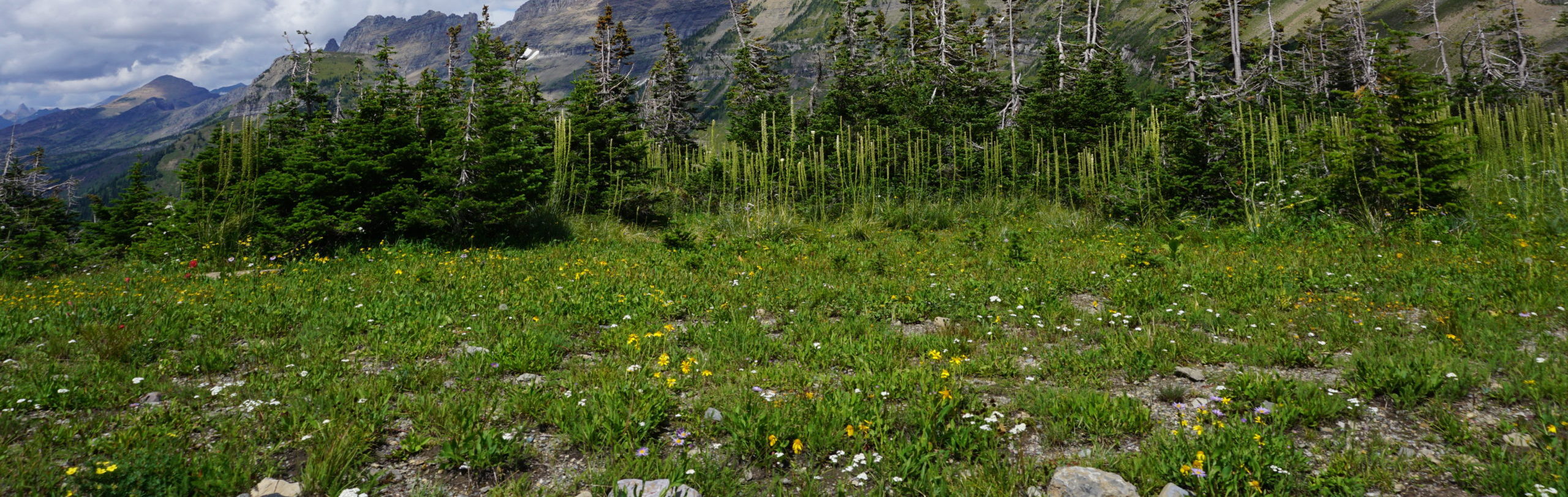
Highlights of Day Six on the WABDR
On day six, I awoke to yet another clear morning on Bethel Ridge. Washington was showing off for me. I wistfully packed up camp and ate breakfast. I knew I had a day of straight and smooth roads ahead of me, so I installed my larger front sprocket on my bike to increase my travel speed at the expense of my low-end torque.

From Bethel Ridge I descended down into the Rimrock Lake valley headed towards Packwood. I couldn’t pass up a photo opportunity of going through the tunnel by Rimrock Lake.
On my way down White Pass, just North of Packwood, I spotted the early stages of what would soon become the Goat Rocks fire that filled much of the state with tear-inducing smoke. I pulled over to take a picture because I was shivering from the cold already, so it was an easy excuse for a break.

I hit the town of Packwood for some fuel and a snack. The town had started to shut down in anticipation of the eventual evacuations that the residents faced, so I was thankful that I had made it into town before White Pass closed. I left Packwood and quickly dropped into an endless network of straight Forest Service service roads with dense tree cover on both sides. The events of the day began to blend together because the scenery was so monotone.


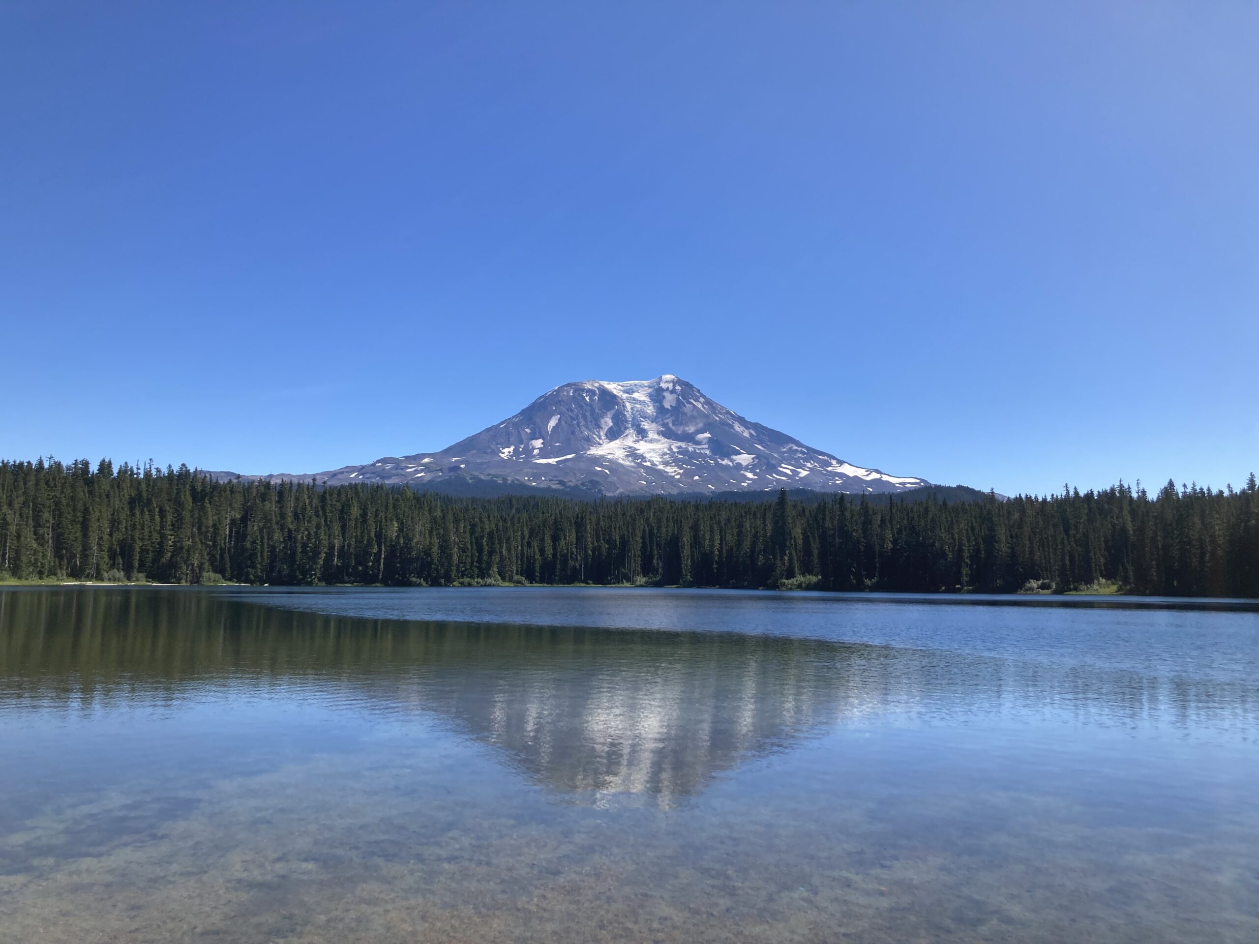
One of the day’s main highlights was an eye splitting view of Mt. Adams from Takhlakh Lake. Takhlakh Lake is drop-dead gorgeous on a clear day, and it is fairly inaccessible, so the crowds on a late Summer weekday are minimal. When I arrived there were only a few people out and one couple canoeing on the water.

This visit to Takhlakh Lake gave me nostalgia for PNW summer camp memories that I never had in the first place.

I explored some of the Forest Service roads around Mt. Adams for a bit before continuing on to my next destination: the Guler Ice Caves.

It was starting to get a little chilly out, and I hadn’t seen anyone else on the road in a few hours. When does it become a bad idea to visit a random hole in the ground with ice formations? Apparently not now.

Most of the trip reports I had seen online just show pictures of people standing around in the cave entrance, but they fail to describe how (obviously in retrospect) cold the mouth of the cave is! I chose to only explore the mouth of the cave because I was cold, and honestly a bit scared of going into it alone. I knew I would return at some point to explore the cave because it is a stirring geological feature. Read the picture of the sign below to learn more about how the cave was formed!

I got back onto the XR600R, looked around to make sure nothing spooky had followed me out of the cave, and sped along the remaining 13 miles to my last campsite of the trip. I didn’t think I had picked an odd time of year to do this trip, but for some reason the South-Central end of Washington was extremely quiet during this time, so I started to feel isolated and remote. It had me questioning if I was in an area I wasn’t supposed to be in, or if there was another reason the roads were empty.

Fortunately, no further hazards materialized and I arrived at my campsite. Well, that part about the hazards was only half true. When I started to cook dinner a bunch of wasps showed up and harassed me to the point that I just stayed in my tent for the rest of the evening. I also accidentally decapitated one of their wasp friends with my drone (I swear, it was the wasp’s fault), so that probably didn’t help my reputation in the wasp world either.

Up until this point, I had been able to avoid crashes (narrowly), mechanicals, and medical incidents for the entire trip thus far, which was a miracle when riding a 30 year-old bike with an unknown amount of miles alone. I noticed in my tent that my lip had split down the middle and it was bleeding slowly. Lesson-learned: bring medicated chapstick on any long rides you have. It’s well worth the weight and size. After stashing my bear bin away from my campsite I fell into a deep sleep.

The Route for Day Seven on the WABDR
I had lofty plans for my last day motocamping the WABDR, but they were thwarted by the same fire that I had seen the previous day – the Goat Rocks fire. I planned to leave my campsite in Washington, head 40 miles South to the Oregon border, and then another 200 miles of mixed dirt and pavement back to my home. That’s riding more than half of the vertical distance of Washington in a single day on a 90’s dual sport speed limited to 55mph. My work was cut out for me.

Highlights of Day Seven on the WABDR
I woke up to my nostrils burning and an abnormally dry throat, and it was at that moment I knew I would be facing some navigational challenges during the trip back home. One of the wildfires in the state had blossomed and dusted its smoke along the valleys that I resided in, and likely many others. The only question was which fire, and where was it?

I started up my bike, hopped on, and rode 41 miles to the border of Oregon – the official end of the WABDR! Nobody told me you had to pay to cross the Bridge of the Gods at the WA-OR border. Part of me wonders if the WABDR terminates at this bridge to increase WADoT revenue through tourism (kidding, but only partially).


One of my relatives was nice enough to drive to the bridge to congratulate me on finishing the route. It always feels good when you have important people in your life support or take part in your crazy adventures! We waited in line with a crowd of PCT hikers for the world’s tallest soft serve ice cream cones. I was trying to figure out which of us needed a shower more, and decided that it was probably me at that point. I said goodbye to my relative and headed North to Seattle!

On my way back North I had to re-route before reaching Packwood to avoid White Pass, Packwood was now evacuated for the Goat Rocks fire as I had suspected earlier in the morning. I followed a curvy bumpy network of Forest Service roads, but this time they were mostly paved, which was a nice surprise. If you follow this route to the Oregon border either North or South there are two things you really need to watch out for: other vehicles and massive pothole/borderline sinkholes in the pavement. I ran into more sections than I could count that had 20ftx20ft depressions in the road, easily an entire foot lower than the rest of the road. Those holes are a bad day waiting to happen, and I ran into some people absolutely laying on the gas on backroads because they assumed the road was free from other users. Be careful out there.
Two-hundred miles later I arrived at my home in Seattle delirious (from sitting in wildfire traffic) and exhausted. In total, I rode just shy of 900 miles on the WABDR – the majority of which were dirt Forest Service roads. This trip was the adventure of a lifetime (so far), and I’ll be back at it again to ride the COBDR in 2023.

Phew, what a trip! If you have any questions about logistics, trip planning, routes, or want to get out on a WABDR trip of your own please reach out through the contact form, or shoot me a message on Instagram – (@HighCaliberCamping)!
-Colin